
 Yahoo Sport


Seven of the best walks in the Lake District: Lakeside routes and places to stay
A 912-square-mile area of fells, lakes and market towns, the Lake District is one of the UK’s most popular destinations for a staycation.
Britain’s largest National Park is home to England’s tallest peak and deepest lake (Scafell Pike and Wastewater respectively), and welcomes almost 16 million visitors per year, with tourists flocking to take in some of the country’s best views and most scenic settings.
While the region’s landscape and villages are among some of the most idyllic and photogenic in the country, many people visit for its vast range of potential activities. Among these, the Lake District prides itself on its range of hikes and walking routes to suit all abilities.
Though the National Park authority offers free guided walking tours, chances are that visitors will want to take their own time to sample some of the area’s vast array of self-guided walks.
Looking for inspiration? Here’s our selection of some of the best.
Ash Landing and Claife Heights
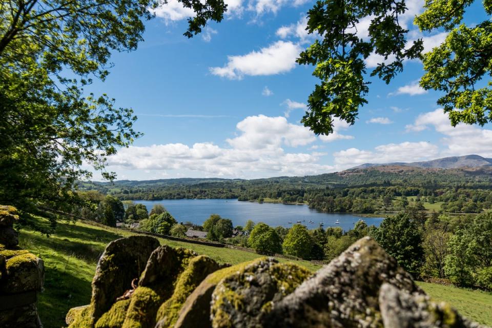
One of the Lake District’s most well-known lakes, Windermere is an enormously popular place to visit due to its myriad water-based activities and walking options. This route is one such walk: a seven-and-a-half mile hike along the less-developed western side of the lake. Starting at Ash Landing, the walk heads north and finishes at Wray Castle, a mock gothic castle built in the 1800s.
While the loop back to Ash Landing is optional, the walk will take you through Claife Woods and across several hills and steep inclines over the course of roughly four to five hours. Low Blind How and High Blind How are good places for picturesque views of Windermere, while Claife Heights itself also provides views of local rivers and rugged terrain.
Where to stay
With a romantic location on the shores of Lake Windermere and modern, stylish rooms, Storrs Hall is the perfect place to stay to appreciate stellar lake views.
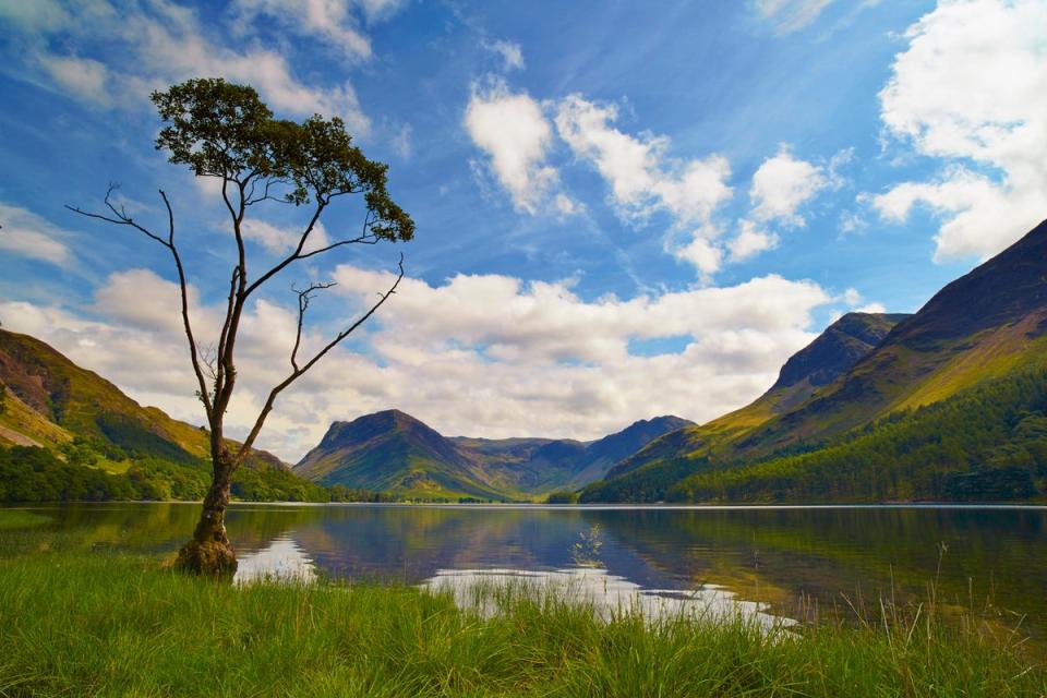
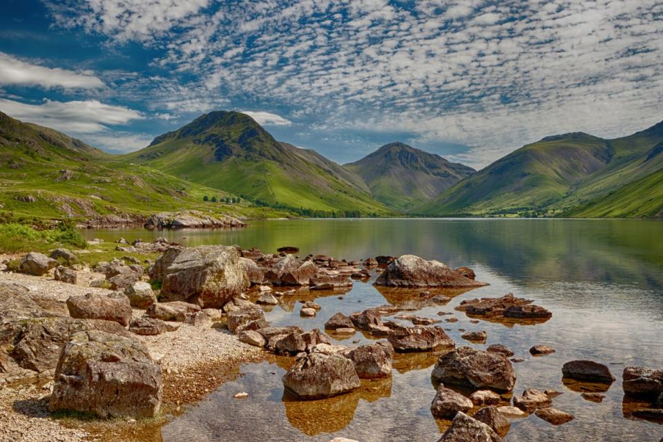
Buttermere to Rannerdale
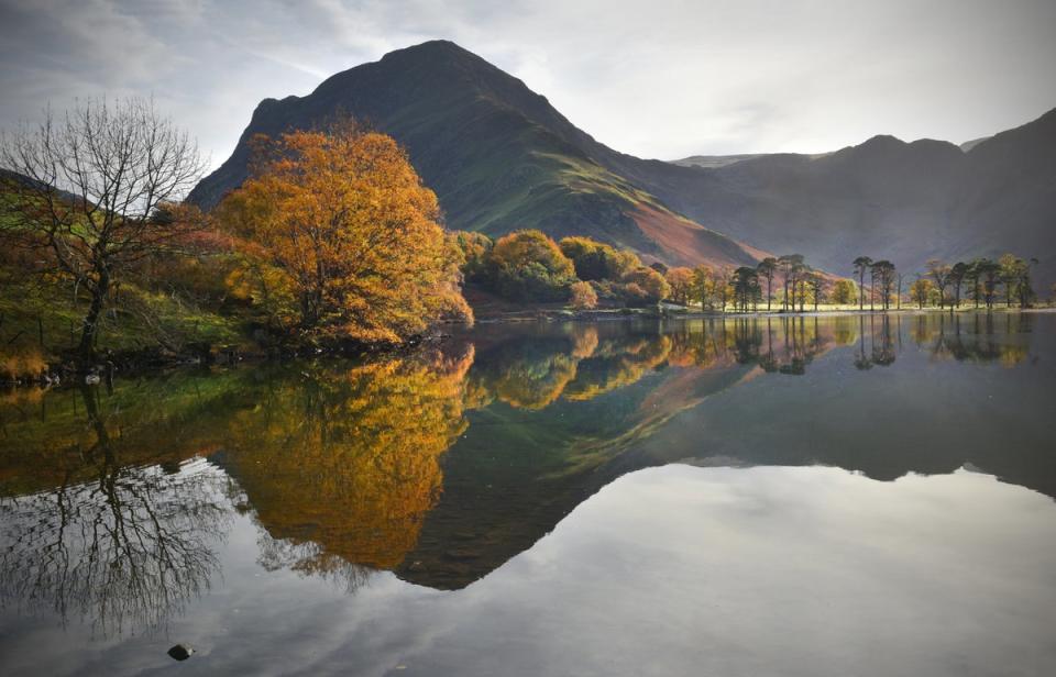
A shorter and more leisurely trail, the three-and-a-half mile route between Buttermere and Rannerdale climbs to the summit of Rannerdale Knotts (with excellent views over the surrounding land). Starting in a National Trust car park in Buttermere, the route should take around two hours.
A particularly scenic walk, it offers views of the ‘Secret Valley’ of Rannerdale (also a popular bluebell walk) and Buttermere Valley, as well as lakes such as Loweswater and Crummock Water.
Where to stay
While the general area does not have a wealth of hotels, Buttermere Court Hotel is clean and comfortable. Less than a mile from the centre, the hotel has its own restaurant and bar area.
Read more on UK travel:
Aira Force and the Gowbarrow trail
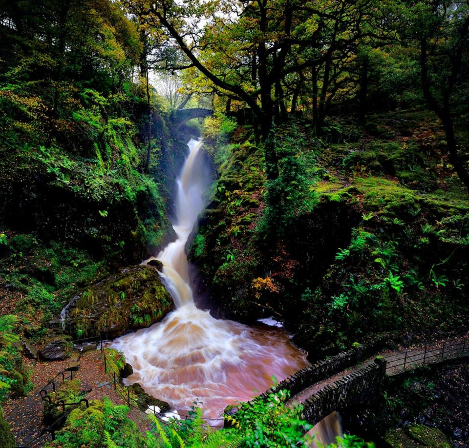
Dubbed as “probably the most famous of the Lake District waterfalls”, Aira Force is a popular tourist spot that attracts visitors for the dramatic scenery and rocky terrain that surrounds its 65ft drop. This route takes you from the waterfall to the peak of Gowbarrow Fell over the course of four-and-a-half miles. When there, you can enjoy views of Helvellyn, Place Fell, Bannerdale and even the Pennines.
Along the route you’ll also find great views of Ullswater, and a pleasant section through Gowbarrow Park to Lyulph’s Tower (a private hunting lodge built in the 18th century). When circling back towards Aira Force, you can also visit the Aira Force arboretum, with specimen trees dating back to 1846.
Where to stay
On the shores of Ullswater in nearby Glenridding, The Inn on the Lake has spectacular views over the lake and the surrounding area. This vast country house offers elegant interiors and three restaurants.
Helvellyn from Thirlmere
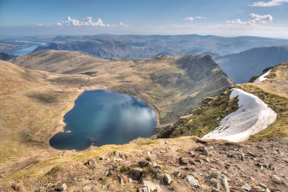
Although more of a challenging hike than a leisurely stroll, the journey to the summit of Helvellyn is worth it for the views alone. There are more difficult and longer trails, with the route from Thirlmere being the ‘shortest’ (some would say easiest) option at four-and-a-half miles and three-and-a-half hours (though the circular route can be up to nine miles). For the least arduous option, head up to the summit via the Helvellyn Gill path and return the same way. The circular route travels over Nethermost Pike and Dollywaggon, down the Raise Beck valley (and its falls) and over to Dunmail Raise, returning via a path.
Whichever route you take, the first views will be those of Thirlmere itself, while the Skiddaw range will become visible as you ascend. Upon completion, you can also say you’ve summited one of the highest points in England.
Where to stay
For a market town experience in between your various walking adventures, the Inn on the Square in Keswick provides a relaxing stay overlooking the town’s Market Square, just 10 minutes from Thirlmere.
Whitehaven colourful coastal walk
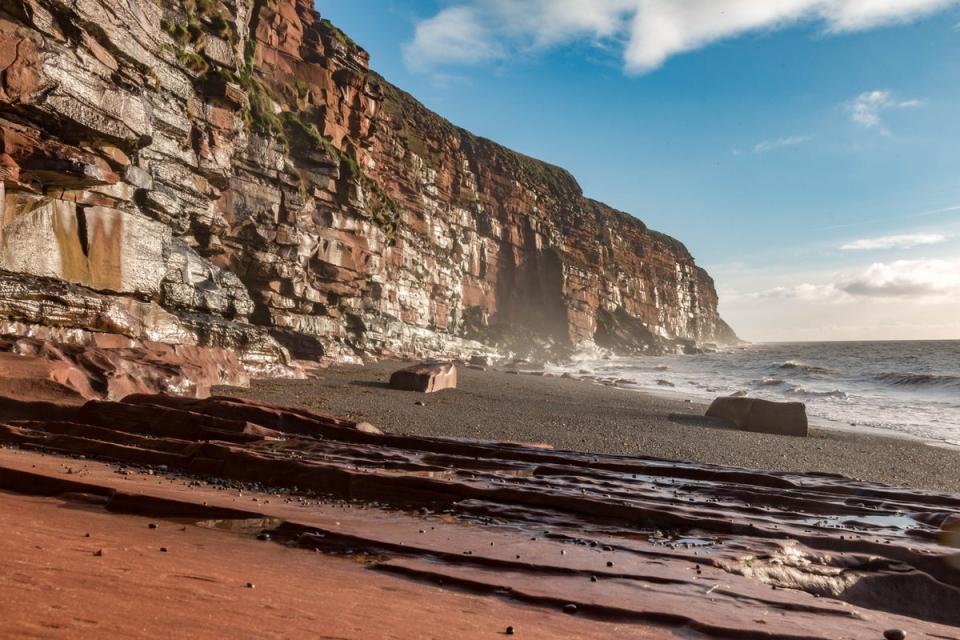
The Lake District may not be renowned for its beaches, but it has some unexpected delights along its coastline. This route explores exactly that, with seven miles of trail starting at Whitehaven’s 17th-century harbour area. To begin with, you’ll investigate the area’s long history – including an old coal mine and a medieval priory – before heading along the cliffs of St Bees Head.
Natural highlights of this rugged coastal walk include Barrowmouth Bay, Fleswick Bay and Saltom Bay, as well as views over the Irish Sea (and the chance to spot wildlife, flora and fauna including jellyfish and different marine mammals).
Where to stay
Though not in Whitehaven itself, Moresby Hall is situated in Moresby, a nearby area that is just seven minutes away from Whitehaven by train. Found in a 17th-century building, the hotel has its own large grounds and walled garden.
Old Man of Coniston
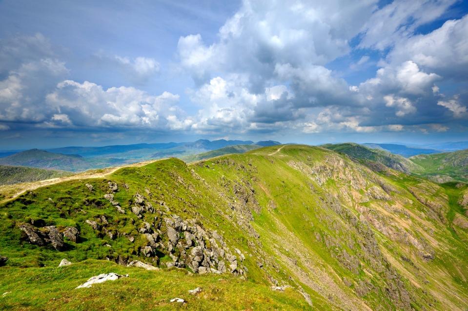
This walk begins in the centre of Coniston, a picturesque former mining village that sits on the tip of Coniston Water, a five-mile long lake where visitors can take a trip on a 19th-century steam yacht gondola.
The six-mile route, which takes between four and five hours, passes some of the village’s mining remains and the Coppermines Valley before reaching the Old Man itself (the highest point of the county of Lancashire), where you can take in views of Low Water Tarn and the Langdale Pikes. One the way down, be sure to enjoy the views of Dow’s Crag and Goat’s Water.
Where to stay
Located right next to Coniston Water, The Coniston Inn has lawns running all the way to the shores to go with its exceptional mountain views. Many of its cosy rooms have views of both, while the restaurant and terrace are an excellent option for an evening drink.
The Corridor Route, Scafell Pike
As England’s highest peak (standing at 978m) and member of the Three Peaks, it’s no surprise that Scafell Pike attracts thousands of visitors every year. The Corridor Route is one of the most scenic trails, though its nine-mile length will be enough to put off some would-be conquerors. The loop begins and ends in a hamlet named Seathwaite, taking roughly six-and-a-half hours to complete, and offering some of the best views in the region.
The walk takes you through rugged, craggy valleys and along small streams until you reach Styhead Tarn. Some parts after this will require using your hands to traverse the small ravines on the route, but you’ll soon join the path with other walkers (usually coming from Wasdale) to reach the summit. Along with the palpable sense of achievement, you’ll receive views of Derwentwater and Skiddaw and the chance for a wild swim at Ruddy Gill.
Where to stay
The immediate area has a dearth of places to stay, but the Royal Oak Hotel sits in nearby Rosthwaite, just seven minutes away from Seathwaite by car (and just three miles from Derwentwater).
Read our reviews of the best Lake District hotels
