
 Yahoo Sport


UK weather: Heavy rain and 60mph winds set to sweep across Britain as March ends in washout
Heavy rain and strong winds are set to dominate this week, with forecasters warning of 60mph gusts.
Thursday will be dominated by an “unstable regime”, acting as the starting gun for more dramatic weather in the latter half of this week.
And though there are currently no warnings for weather in force, the Met Office has urged Britons to keep an eye out as there could be updates closer to the time.

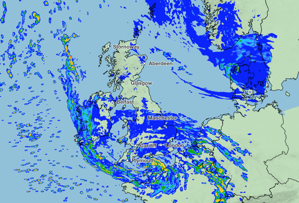
Looking to Wednesday first, the forecaster said bands of heavy rain and showers will move northeastwards across most parts of the UK, especially along the western flank.
The rain will push through to the Midlands by the end of the afternoon before then making its way northeastwards across the UK later in the day.
Around 10-15mm of rain is likely to fall across southern parts, while between 20-30mm is possible over higher ground in South Wales.
But wrapped in there is some mild air, with highs of 15-16C, perhaps even 17C if we get some sunshine in the southeast and east of England,
☁️ A cloudy start to Wednesday for most with outbreaks of rain moving in from the southwest through the morning
🌬️ Breezy, particularly in the west
🌡️ A milder day than Tuesday, and feeling warm in any sunny spells pic.twitter.com/9lYkzwaZDv— Met Office (@metoffice) March 28, 2023
The Met Office told The Independent there would be some strong winds in the Outer Hebrides this evening and then also across Shetland tonight, bringing gusts of around 40mph.
But it said the main watchpoint for wind in the forecast is Thursday night into Friday, when an area of low pressure moves eastwards along the English Channel.
The area of low pressure will travel across from the US, where a cluster of thunderstorms were recorded on Monday night.
As it gets picked up by the jet stream, it could deepen into quite a significant area of low pressure for the start of Friday, say forecasters.
The Met Office told The Independent that parts of Cornwall and South Devon could see 45-58mph gusts overnight and into Friday.
“The strongest winds from this low pressure are expected offshore in the Channel and across the Channel Islands and Northwestern France. As the low pressure moves east the strong winds will track along the south coast,” a spokesperson said.
On Thursday, the strong winds will be combined with heavy rain, where 30-40mm is possible over six hours in the southwest of England and South Wales, they added.

Met Office 5-day outlook
Wednesday
Bands of rain and showers moving northeastwards across most parts, heavy at times, especially in the west. Some bright spells too though, and feeling very mild despite strong winds.
Wednesday night:
Rain clearing east from all but the Northern Isles overnight with clear spells and a few showers following, mainly in the west. Mild and rather windy.
Thursday:
Rain slowly clearing from the far northeast. Mild with a mixture of sunshine and showers elsewhere, locally heavy. Cloud, rain and strong winds developing in the far southwest later.
Outlook for Friday to Sunday:
Sunshine and showers on Thursday, then turning wet and very windy in the south overnight. Rain or showers for many on Friday and Saturday, turning drier in the west. Cool.
