
 Yahoo Sport


Ukraine Dam: Before And After Aerial Photos Capture The Catastrophic Flooding

The roof of a house is seen in the Dnipro river which flooded after the Nova Kakhovka dam breached.
The destruction of a critical dam in Ukraine’s Dnipro river yesterday morning has caused devastation for the surrounding areas.
The dam was full when it was damaged early on Tuesday morning. Around 42,000 people are at risk, according to Ukrainian authorities, with some people being forced to spend the night on building roofs.
Ukrainian president Volodymyr Zelenskyy has alleged that many will be left without drinking water as a result of the bombing, while Moscow has claimed that a state of emergency has been established in the parts of the region it has annexed.
Ukraine has blamed Russian forces for destroying the dam, claiming that they set off an “environmental bomb of mass destruction”. Russia, meanwhile, has blamed Ukraine, saying Kyiv attacked the dam to distract from what it says are the failures in its long-awaited counteroffensive.
While details of the attack are still being uncovered, the destruction of the dam risks affecting the downstream, occupied peninsula of Crimea, as it is reliant on water coming from the Dnipro River.
Upstream, the nuclear power plant in Zaporizhzhia is also dependent on the water supply for its cooling systems – although authorities in the region say the area is safe, for now.
Aerial photos, captured by Maxar Technologies, show how the surrounding areas in the Kherson region – which is partly occupied by Russian forces – have been badly affected by the flooding, by comparing before and after shots.
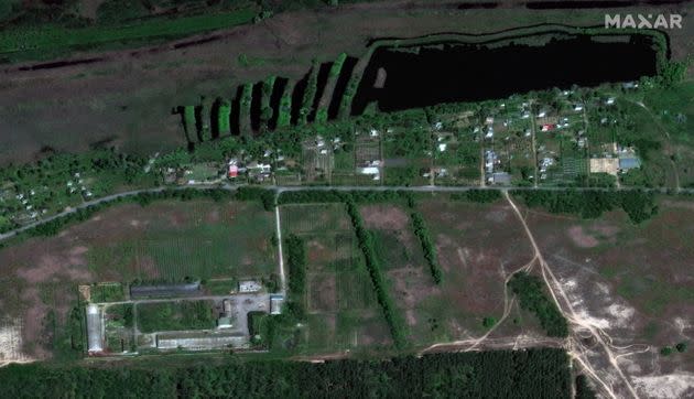
Before
A satellite image shows the village of Krynky, Ukraine, before the flood – May 15, 2023.
After

A satellite image shows the flooded village of Krynky, Ukraine, June 6, 2023.
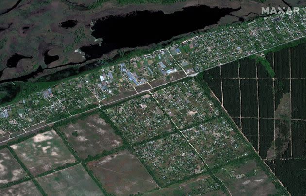
Before
A satellite image shows homes and farms in Korsunka, Ukraine before the flood – May 15, 2023.
After
A satellite image shows flooded homes and farms in Korsunka, Ukraine, June 6, 2023.
Before

A satellite image shows a view before homes were flooded along Dnipro River southeast of Kherson, Ukraine, May 15, 2023.
After
A satellite image shows flooded homes along Dnipro River southeast of Kherson, Ukraine, June 6, 2023.
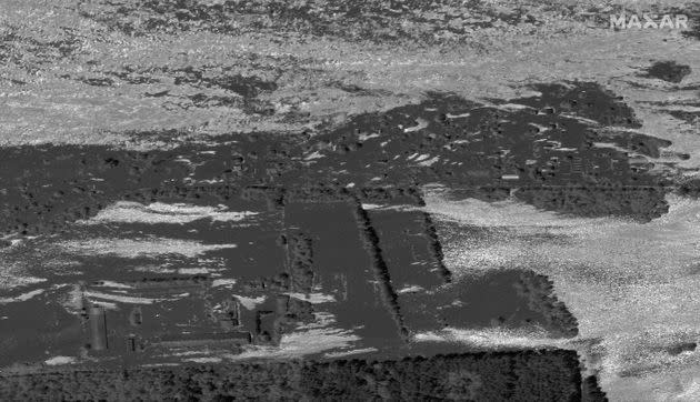
Before

A satellite image shows a close-up view of the port facilities and industrial area before flooding, in Kherson, Ukraine, before flooding – May 15, 2023.
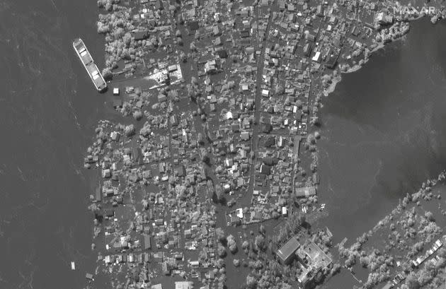
After
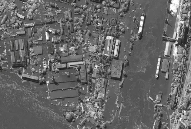
A satellite image shows flooded port facilities and industrial area, in Kherson, Ukraine, June 6, 2023.
Before

A satellite image shows homes in Krynky, Ukraine, before flooding – May 15, 2023.
After
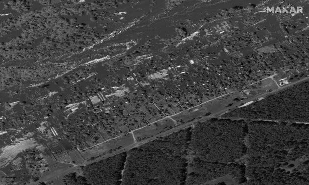
A satellite image shows flooded homes in Krynky, Ukraine, June 6, 2023.
