
 Yahoo Sport


Met Office extends UK weather warning as thunderstorms batter southern England
The Met Office has extended warnings of power cuts, travel disruption and flooding after heavy rain and lightning battered southern England and Wales overnight.
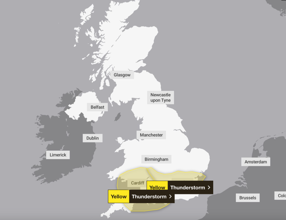
A yellow thunderstorm warning for south east England was put in place between 11pm on Wednesday to 6am on Thursday, but was extended to 10am.
Meanwhile, a separate warning covering an area stretching from Portsmouth to Plymouth, and northwards to South Wales, was in place between 8pm on Wednesday and 8am on Thursday.
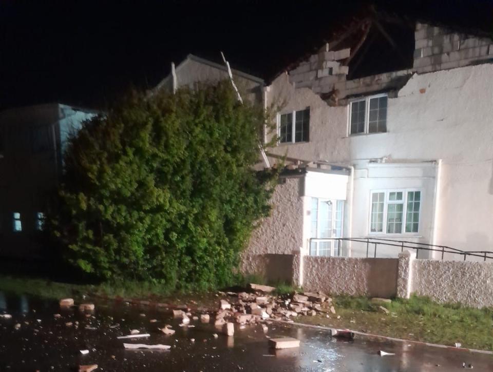
Overnight, a care home in Elmer, West Sussex, was struck by lightning and sustained damage to its roof, according to West Sussex Fire & Rescue.
A university building in Chichester was also struck, causing damage to its roof and power system, the city’s fire service said.
Videos and photos posted on social media by residents of several southern cities showed the impacts of heavy showers and the constant rumbling of thunder.
Some members of the public described it as one of the worst lightning events they had seen in a long time. “Crazy lightning tonight,” wrote Kerry Groves, a resident of Haywards Heath. “Not seen this much in years.”
The Met Office warned commuters on Thursday morning to expect difficult driving conditions, road closures and some flooding ahead of what is expected to be another warm day.
There is also a chance of delays and some cancellations to train and bus services, along with a small possibility of power cuts.
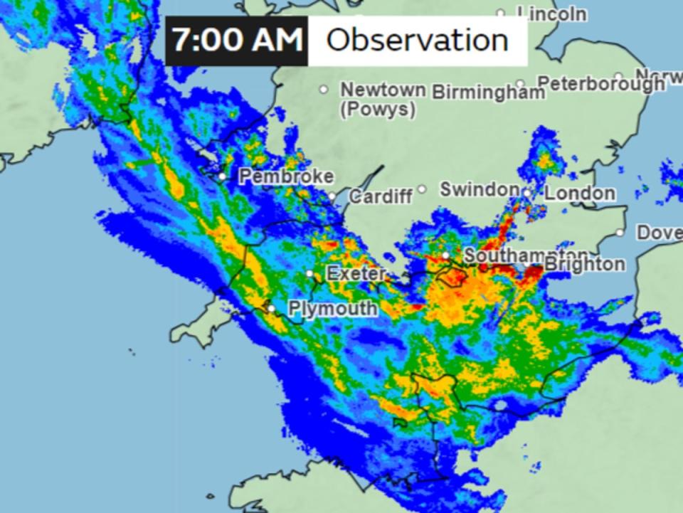
On Thursday morning, Met Office maps show up to 32mm per hour of rain falling in some regions as unsettled weather continues.
The unsettled weather was expected to continue in the morning with more lightning storms heading towards the country.
However after a period of storms rainfall is expected to ease during the day, according to Marco Petagna, a meteorologist at the Met Office.
“We could see the skies brightening up in a few places and it will be another warm day,” Mr Petagna said.
Some parts of the country could see their warmest temperatures of the year on Thursday, Mr Petagna said. This would come a day after Wednesday saw temperatures peak at their highest yet in 2024 at 22.1C. Parts of the South East could reach 24C, he suggested.
“But as the skies brighten and temperatures increase, this could spark a few more thundery showers in the afternoon, so it is likely to still be a bit unsettled and the forecast will be changeable over the next few days.”
While southern parts of the country will experience heavy rain, areas in the North should stay dry and warm. For the week ahead, the Met Office says the weather will continue to be a “very mixed picture”.
Most areas of the country are likely to experience some rain but temperatures will remain fairly warm, in the mid to late teens.
The wet start to May comes after last month became the sixth wettest April for the UK since records began in 1836, with an average of 111.4mm of rain across the country, according to provisional Met Office figures.

